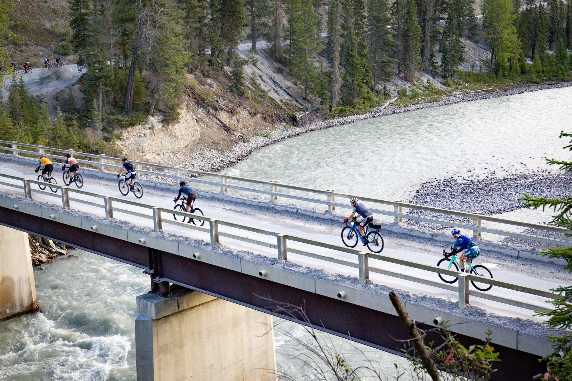
The Race
A gravel route so spectacular, you’ll never want it to end!
High mountain passes, wildlife, views—our stages have it all
At TransRockies, we’ve been designing cycling and running routes in Canada and the United States for nearly two decades. Our first stage race, the TransRockies Challenge, began in the Canadian Rocky Mountains, and now we’ve returned with an epic gravel stage race. This is one of our favourite places to ride, and we’re sure it will become one of yours too!
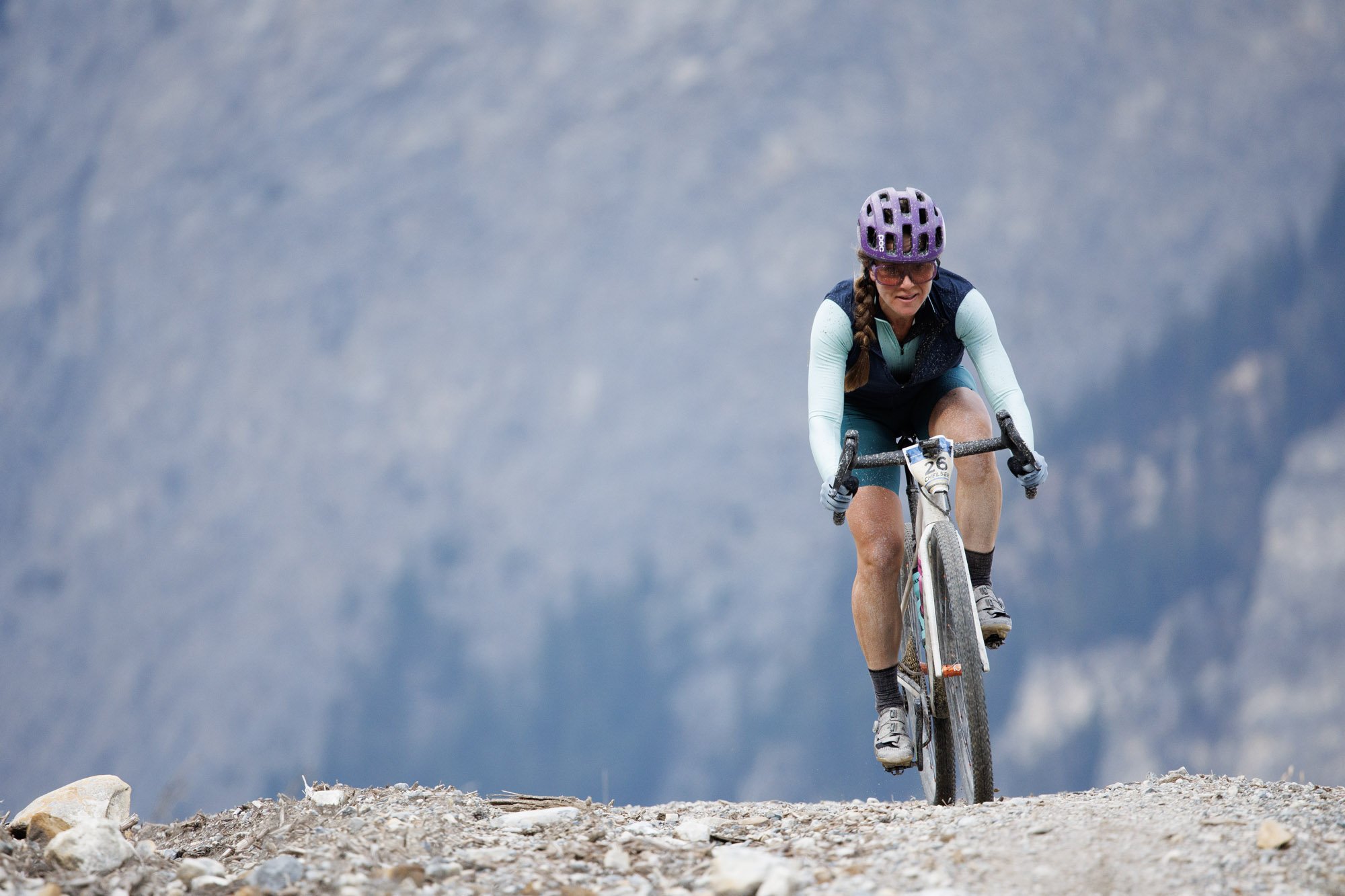
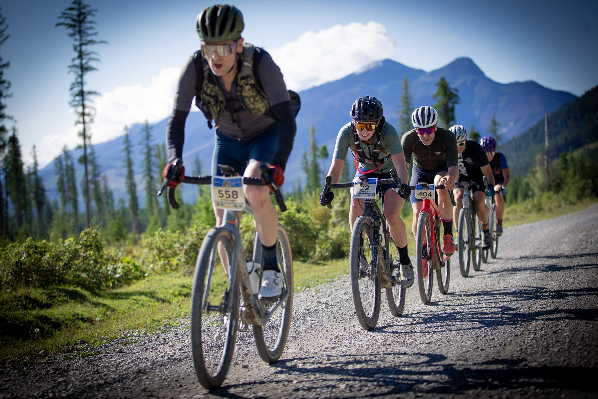
Every stage is designed around adventure, with spectacular views and the chance to spot wildlife as you ride. Each day, racers will conquer a new mountain pass on their way to the finish line.

Returning for 2025, riders will be welcomed on arrival day with an optional Shake Out ride, followed by a 3-day stage race starting the next day. Two distances will be offered each stage– a “Full Pint” with a daily distance of 90-120 km (about 75 mi) and a “Half Pint” with a daily distance of 40-85 km (about 50 mi). Riders can compete for stage podiums and general classification in either the Full or Half Pint, or just jump into whichever ride distance suits them for a fully supported ride each day.
In total, the full 3-day course (we like to call it the Royal Flush) extends approx. 300km and climbs over 5,500m for the full pint course. The Half pint option serves up around 200km and 3,500m of climbing. The majority of the route is gravel road with some sections of double track and narrower deactivated roads.
We pride ourselves on the rugged and remote nature of our stages, but that doesn’t mean you’ll be left to fend for yourself. We ensure an expertly marked course, 2 checkpoints per stage, as well as ambassadors and course crews, ready to lend racers a helping hand.
Each day will have you crossing the finish line with a dusty grin from ear to ear, and memories that will last a lifetime.
See below for course, stage and rider support details.
Go ‘all-in’ on adventure with us!
The TransRockies Gravel Royale is more than just a race. Visit the pages below to find out what makes it a truly epic adventure.


The Stages
The TransRockies Gravel Royale is a remote tour of the Rockies primarily on Forestry Roads. It also features sections of doubletrack and trail and can be considered a “multi-surface” cycling adventure.
Full Pint Route Stats (subject to change)
Distance: Approx. 300 km or 190 miles
Elevation Gain: 5,500 m or 18,000 feet*
plus optional shakeout ride
Half Pint Route Stats (subject to change)
Distance: Approx. 200 km or 125 miles
Elevation Gain: 3,500 m or 12,000 feet*
plus optional shakeout ride
*Elevation data may be highly variable by device or mapping platform, as different software may use various data sources and calculation methods.
Important Note: Depending on the time of year, not all stages are always passable due to snow, high water crossings, road and bridge damage, deadfall trees, and heavy brush. Bears and other wildlife are present on the route as well. Watch for active logging, logging trucks and mine trucks. If you’re heading out to check the course, please email aaron@transrockies.com for specifics on the portions you are hoping to ride. We recommend carrying Bear Spray and a folding saw. Also, if you have explored parts of the route and can report on conditions, or if you are interested in helping with brushing the route, please send us an email as well.
Stage 0 - Shake Out Ride (optional)
Full Pint: 21.4 km - 270 m climbing | 13.3 mi - 886 ft climbing
Stage 1 - Palliser River Route
Full Pint: 110.6 km - 1,713 m climbing | 68.72 mi - 5,620 ft climbing
Half Pint: 72.9 km - 974 m climbing | 45.3 mi - 3,196 ft climbing
Stage 1 takes us far up the Palliser River drainage into the heart of the "Royal Group" of mountains, the namesake of Gravel Royale, just a stone's throw from the continental divide. The stage is a rolling climb for the first 36 km, at which point the half pint will return the way they came with a cruise back to Nipika. The full pint will continue with another 16 km of gradual climbing before returning back down the Palliser. On the return trip, riders will reverse stage I's major climb, ascending Little Elk Creek and descending Cochrane Creek before arriving back at Nipika.
Stage 2 - Miller Pass Route
Full Pint: 96 km - 1,621 m climbing | 59.7 mi - 5,318 ft climbing
Half Pint: 82.7 km - 1,379 m climbing | 51.4 mi - 4,524 ft climbing
Stage 2 starts on Nipika's cross country ski trails rolling north through the Cross River Recreation Area. From there you're back on good gravel roads to the high point of the day at Miller Pass. Full pint riders will enjoy and additional out and back section up the Cross River. For the next 7km we are using old roads that have been unmaintained for decades and have been cleared specifically for this event in order to make the connection from the Cross River to the Albert River Valley. The initial descent is a rough and rocky double track to the first of several creek crossings which will require you to get off and cross on foot. Things get a little jungle-like in here for a few kilometers. We clear the brush prior to the event but you will still likely experience some branches in your face and limited sight lines. Fortunately you will mostly be coasting downhill until you get to the Albert River Forest service road. The rest of the stage is rolling hills on good gravel roads. The stretch from the "Jungle" to Checkpoint 2 along the Albert River is particularly scenic.
Stage 3 - Ravenshead Route
Full Pint: 88.9 km - 1,568 m climbing | 55.24 mi - 5,144 ft climbing
Half Pint: 62.5 km - 1,076 m climbing | 38.84 mi - 3,530 ft climbing
Stage 3 will have riders will roll south from Nipika Mountain Resort along the scenic Ravenshead, treated to breathtaking mountain vistas right from the start. About 20km in, the route hits an epic 10km climb — a true test for the legs and lungs. But don't worry, what goes up must come down. This out-and-back section means you’ll be rewarded with a thrilling descent before rejoining the Ravenshead for a fast, fun, and flowy ride all the way back to Nipika.
Is it technical?
You might be wondering - how technical is the riding? Do I need any special skills to participate?
The amount of technical riding in the 2025 Gravel Royale has been significantly reduced compared with the 2022 version.
In general, you don’t need any special bike handling skills, but you may not be able to ride all sections depending on your skill and experience level. Those with a mountain biking background or significant gravel or cyclocross experience will typically be more comfortable on the sections that are more challenging. The route does contain some sections of rough or technical riding which will slow you down, although the majority of the mileage is on good gravel roads. If you have to get off and walk for a section - no big deal, it’s all part of the adventure! The vast majority of the route is strait forward riding, requiring no special skills. If you have an option to use higher volume tires and lower gearing, that may add to the comfort level as well.
General tips:
Industrial truck traffic is infrequent but possible - watch for loaded logging and mine trucks and get to the side of the road.
Caution required on some downhills in case of potholes, ruts, loose or rough sections
Always a possibility of unexpected hazards or conditions